Risk's Ultralight Hiking

The skills involved in setting up a light backpack serve well for both hiking and touring. Learning what is really necessary and then finding high quality gear that meets my honest needs leads to much less carried and more fun. I hope this journal is as much fun to read as it is to write.

Saturday, May 20, 2006

Blue Ridge Parkway - Day 4


Saturday
305 miles
Starting: Grafton WV
Ending: Dayton OH

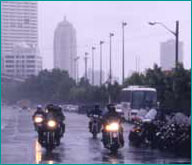
I began the day before 7 AM with a fuel stop in Grafton.  The city was shrouded in fog as thick as pea soup.  The roads were quite twisty and narrow and wet. It made driving in the fog a chore. 

Outside town, on top of a ridge, I caught sight of clear skies above, just before plunging into the thick fog once more.  This continued to Clarksburg, where the sky cleared, and the road became a standard 4 lane divided highway, but with only some of the entrances being cloverleafs.  There were still some traffic lights and some direct entry onto the road. 

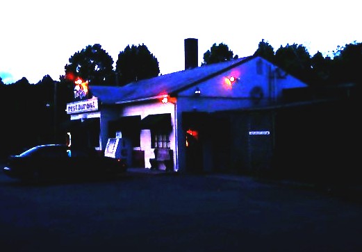
But after a bunch of miles on poorly improved two lane roads, the road way surface was both dry and free of gravel.  This was very good.  I had breakfast at a McDonalds in Clarksburg, where a group of Honda Pacific Coast bike owners were gathered for a ride.  Their bike is a sweet little thing - 800 cc with a trunk for storage!  Shaft drive, but unfortunately not built in the last 7 years. 

The drive from Clarksburg to Parkersburg was easy and fast. The good road continued to Athens Ohio, and then a very familiar part of US 50 took me to Chillicothe and back to Dayton.

When I was in Chillicothe, I called my riding and hiking buddy Mike K, who was at the Dayton Hamvention.  We agreed to meet there about 1 PM - a get together which worked out great - Hamvention has special close parking for motorcycles.

I had fun talking to some friends from the amateur radio world and then headed home. 

It was a great half week trip, full of interest, interesting places, weather experiences, and a good look at the country.  I can't wait to get out and do it again.

Friday, May 19, 2006

Blue Ridge Trip - Day 3


Friday
Miles today: 449 (total of 4380 miles on the VN750)
Weather: A little sprinkle, lots of sun, but the roads were often wet as I was chasing thunderstorms.
Begin: Tuggle Gap, VA on the Blue Ridge Parkway,
Ending: Grafton, WV
Hours driven: 14.5 (new personal record)

Today's trip began with the upper portion of the Blue Ridge Parkway. From the time that I climbed out of the Roanoke area, this was a section of the Blue Ridge that I know from hiking the Appalachian Trail that parallels the BRP. The northern part of the parkway has a different feel from the southern parkway. The curves are more sweeping and it is easier to stay in 5th gear for much of the time.

It was fun seeing all the places that I had stopped last year while hiking the trail through this section. The Peaks of Otter's small nature museum was not open at the hour I went by. The breakfast room and bookstore at Otter Creek would not be open for another week according to the girls that were stocking the bookstore.

I refueled at Waynesboro and entered Shendoah NP. The cost of driving a motorcycle through the park had risen from the previous year. It now stands at $10, where it was $5. This is a 7 day fee, but it only takes part of a day to drive through the park...

I continued down memory lane in Shenendoah, having also driven all of the park last year on a motorcycle while I was hiking (I used it as a self shuttle) The park's speed limit is only 35, as compared with the Blue Ridge Parkway's 45. The roads are about the same as the southern 200 miles of the Blue Ridge Parkway, and 35 mph often seems like the best speed to be taking.

I reached the northern end of the park about 3 PM and headed out across West Virginia on the way back to Ohio. I started in Front Royal and drove to Winchester on US 522, where I took US 50 west. US 50 was a major road for most of the rest of Virginia, but turned into a much twistier road in West Virginia.

I was driving on wet roads with occasional gravel. Hairpin turns were common. Late in the day, I crossed a small sliver of Maryland where the roads were markedly better than the West Virginia roads. My hope was to camp at Cathdral State Park, but that park did not have any camping.

The section of road from Auora to Macomber was as difficult to drive as any I have seen. There were large altitude changes, especially coming into Macomber, with dozens of hairpin turns that could only be negotiated at a snail's pace.

I looked around the Macomber area for camping, as this was down in a valley, but the locals knew of no camping areas, either private or state park. So I elected to continue to Grafton where I found a nice hotel for about $50 with carpet, a working TV and a nice shower.

Long day... Getting off the bike, I realized how tired I had gotten. The seat was comfortable to the end. No pain - just tired. I pulled the gear off the bike and into the motel room where I feel a deep sleep coming on.

Thursday, May 18, 2006

Blue Ridge Trip - Day 2


Tuggle Gap had good food and an OK room

315 Blue Ridge Parkway miles
I rode from 0630 to 7 PM
Weather: chilly, windy, with 3 hours of rain and an hour of thick fog
Starting Location: Orchard View Picnic Area
Ending: Tuggle Gap

I began the day near milepost 455 on the Blue Ridge Parkway after spending the night in my hammock. I was plenty warm and slept well, but I woke with a start - thinking that my hammock was being bumped by an animal or a person. However, nothing was there and there was no sound of an animal running away. It must have been a dream!

I passed the highest point on the parkway - 6047 feet. I was in the clouds at that point. I then descended to the Ashville area and got gas at about mile 380, near the folk art center. Average miles per gallon is well above 50. I asked for a Blue Ridge parkway map at the information center there, and was told that the map of the parkway is in short supply and new ones are not available. I had been told the same thing at the store at Mt. Pisgah.

I drove the short spur to the top of Mt. Mitchell, which tops out at 6684 feet. This is the highest point east of the Mississippi River, higher than Clingman's Dome by many yards. The temperature was 42 and the wind was measured at 25-35 mph. It was completely fogged out, and began to rain. I was told that this was much better than two days previously when there was an inch of snow on the ground.

It rained about an hour, and I was just dried out by the time I reached Linville Falls. Wow! The falls were beautiful to see and to listen to. To properly see them, I took a couple miles hike to all the observation points. Lying down next to the falls and listening to them was quite refreshing.

Soon after leaving Linville Falls, it began to rain again. There were pretty bridges at Linn Cove Viaduct, but I had my hands full just seeing the road in the rain and fog. It was still raining when I got to Blowing Rock and filled the tank with a little less than 2 gallons (mile 292) I got gas again at mile 175 (2.1 gallons)

I expected to camp at Rocky Knob - but the campground is at 3572 feet and it was cold and windy. Also, I found that there were no showers in the campground. So I went on a few more miles to Tuggle Gap where i got supper and a room for about $55. (Happy Birthday to Me)

The room is plain, with no TV, but it has a hot shower and heat. My bike is parked outside the door. It will be a nice night for reading.

Wednesday, May 17, 2006

Blue Ridge Trip - Day 1


Miles: 426
Begin in Beavercreek, OH
End Near Maggie Valley, NC
Weather: mix of sun and showers

This is a trip I have been looking forward to most of the winter. My plan is to drive the Blue Ridge Parkway. For several days beforehand, I have been looking at the weather patterns, and it looked like it was going to clear and beautiful on the southern end of the Blue Ridge Parkway by mid-week. Here it is Wednesday, and I have the opportunity to get out of Dodge for several days.

I started at 830, filling my gas tank in Beavercreek. My route proceeded south on US 68. I stopped at Mt. Orab for coffee and for a breakfast burrito in Ripley, OH. At 1120, I filled the tank in Paris KY, having gotten 127 miles out of the tank.

In Paris, I took KY 627 around Lexington. South of Paris, the road is flanked by beautiful rock walls and horse farms to the town of Winchester. South of Winchester, I stopped for a few minutes at Fort Boonesboro. The river valley is very pretty here, but there is not much more than an water park to recommend the stop. I had been reading about Boonesboro since I was a child and had never been here. I must admit to a little deflation at finally arriving.

Next came Richmond, KY where I took US 25 south. I had to stop for a moment at a police check point (drugs? alcohol?) and reached New Liberty, where my grandmother was raised.

I took I 75 to 25E. This road is a beautiful and not heavily traveled road that goes all the way to Newport TN. I filled the tank again at Newport and drove for 40 miles on I 40 to the Magee Valley turn off.

In Maggie Valley, I noticed that one of the small motels had a sign welcoming VROC. This is the Vulcan Riders and Owners Club, one of the Vulcan motorcycle groups on the internet. I stopped for a few minutes to say hello and then drove off to eat barbeque at a small diner. Unfortunately, I missed the motorcycle museum by 45 minutes.

I drove up from Magee Valley to the Blueridge Parkway and then north for a few miles to a turn-off picnic area (Orchard View) where I put my hammock up. The ranger kept driving by every hour or so for half the night, each time waking me with his car. He was probably trying to figure out where the motorcycle owner was.

Other than those interruptions, the night was nice and I got plenty of sleep.

Saturday, May 13, 2006

Riding in the Rain


Yesterday, Friday, I decided to take nature on and see how comfortable I was riding in the rain. I know how to walk in the rain, and I thought I might know how to ride in the rain as well.

Rain is one of those stresses in hiking that can get under one's skin. A year ago, it was several days of foggy, rainy weather that brought my hike to an end after just under two weeks. I had planned to be out for more than a month, but the cold rain beat me to submission. Since then, I have done a lot more thinking about rain and have continued to aspire to what I wrote about in my book ("A Wildly Successful 200-Mile Hike"). I have tried to learn to be as comfortable in the woods during rainy weather as the animals that live there.

We are presently camped under a geographically stable low pressure system that has brought rain all day for the last 4 days and will probably keep rain in the forecast for several more days to come.

Instead of looking at the rain outside, I took it "under advisement" and planned a little trip in the rain.

The rain yesterday was not very hard - more like a steady sprinkle that continually drippped into all the puddles on the road. The temperature was about 44 F. On top of that, there was wind whipping around at about 25 mph.

I wore my full face helmet, a Land's End waterproof/windproof jacket that zips to under my chin, the pants from a set of Frog Toggs, a pair of goretex gaiters made by Outdoor Research, and leather boots treated with SnoSeal. I wore a pair of leather gloves treated with SnoSeal with wool liners and a heating pouch inside the wool liner on the back of my hand.

I set out to go to Chilicothe, OH. However events (a call for assistance by my teenage son) had me turn around at the 42 mile post. I was drinking a cup of coffee at a gas station when I learned I needed to email him a paper he had written the night before. So I turned around and drove back.

I stayed dry for the whole trip. I stayed reasonably warm (though it would have been nice to have a little heavier shirt under the coat.)

What I did not expect was how tiring the wind was. The road I was on was an E/W road and the wind was directly from the south, across unbroken farmland and hit me hard enough that I was leaning into it to stay on a straight path. Of course, it was not all that steady, especially when cars and trucks passed. Together with worries about the possibility of slipping on wet pavement, it was very tiring.

So, good news on the waterproofness, bad news on the idea of riding in cold rain all day. I think that by the time I had driven several hundred miles, it would have been getting very old!