Risk's Ultralight Hiking

The skills involved in setting up a light backpack serve well for both hiking and touring. Learning what is really necessary and then finding high quality gear that meets my honest needs leads to much less carried and more fun. I hope this journal is as much fun to read as it is to write.

Friday, July 28, 2006

Sleeping with a Fibular Fracture

This is a cross post from the hammock camping yahoo group.

As I reported earlier, I fractured my left fibula 23 days ago while hiking the AT in Maine.

I have continued to improve steadily and have been walking on my leg fairly well for a week now. It is not up to full strength yet, but the swelling is down and I no longer need a splint or a walking stick.

In preparation for some car camping I am planning for early next week (Balsam Mountain in the Smokies) I checked to make sure that I can use my hammock. Unfortunately, I can't do that yet.

In all of the 5 or six comfortable positions I usually use in a hammock to sleep, I have found that my foot is pushed one way or the other. And pushing my foot in a twisting motion and then keeping it in that position still hurts. I can partly overcome those problems by using a bag of clothes as a small pillow to lift the foot so that it neither is twisted, bent, or dangled, but it is a bit complicated to set that up, and staying in one position for long with my leg in its present state of healing causes me cramps...

So I am reduced, for the car camping episode this coming week, to sleep flat on the not so flat surface of the earth. I can't believe it is happening to me. Pray for my sanity. Maybe I will still dream of swinging free of the roots and stones of the ground.

I hope that in a week or two the bones will be knit together well enough to allow me to sleep in the hammock once again.

Risk
Ground Sleeper (Prov)

Saturday, July 15, 2006

Foiled in the 100 Mile Wilderness


It's been 10 days and I am beginning to feel OK about it.

On Monday, July 3rd, I left Dayton and drove to central Maine. In the back of the pick-up was my GS450, strapped in and ready to roll.

I dropped the truck off on Tuesday morning at Abol Bridge in the shadow of Mt Kathadin and drove my bike 90 miles to Monson, Maine. I arranged to keep the bike there for about a week and entered the 100 mile wilderness, headed north with 6 days of food.

It rained on my trip down to Monson, hard thunder storms with lots of lightning. It dried out for a bit in Monson, but began sprinkling sometime after 6 PM and rained on and off until I reached the Wilson Stream lean-to at dark.

The night of the 4th was brilliant with the Creator's own fireworks, and I enjoyed them very much with about 8 others at the shelter.

The next morning, I set off for about 15 miles of hiking in the wet woods. I was a little disgrunteld that the trails had not been recently maintained and the bushes on both sides of the trail crossed and linked branches, giving only scant views of the roots and puddles on the trail.

About 4 miles into the day's walk, I fell down a 10 foot boulder and heard a bone in my left leg crack. That was not good.

It hurt too.

I unbent all my legs and found that there were no bones sticking out through the skin. That was great news. THe ankle was not badly strained and when I tried to put weight on my leg, I could limp pretty well. I had to be very careful with each step, because the outside of the leg, where my fibula is, was very tender and I could feel some movement of bones in that lateral part of the leg.

I walked about 2 miles to a cross connecting gravel road that showed on the AT map, and which connected with a road that headed back to Monson. I walked about 3 miles on that gravel road and was able to get a ride back the rest of the way to Monson.

Though things hurt pretty well, I was able to ride the bike and return to Abol Bridge and then (because the truck is an automatic) I was able to drive. I drove to Augusta
that evening and get a motel room and a very long day of driving on Thursday got me back to Dayton in time to watch the midnight news.

The next morning I went to the hospital and the xray showed an isolated spiral fracture of the fibula. The mechanism of my injury was likely that while I was falling, my foot turned out and then my knee rode up and over the foot, twisting the ankle like a twistie tie. My knee hurt some as well, but all the injury to the knee seemed to be involved with the exterior ligaments on the medial side of the left knee.

I was able to persuade the docs to give me a brace instead of a cast and here 10 days later the fracture is beginning to feel OK. It has sure ached a lot in the meantime.

I am looking forward to getting back on the bike in a week or so and back to hiking in about a month.

Such is life....

Friday, June 09, 2006

A hot day trip to Flint Ridge


It seemed like a good day for a trip.  The weather was warm (70s to 80s) and everyone else in the family was off doing other things for the whole day.

I left right after breakfast and drove to the east, via US 42 to South Charleston and London, Ohio.  I left London via state route 142 to US 40 which I took into Columbus and the Broad Street entrance to I 70.

I had looked at downtown Columbus on the map and decided to forego the fun of all those lights by taking I 70 through town.  However, on the far east side of town, I hooked north to US 40 in Reynoldsburg.  This was a small mistake.  The traffic was pretty heavy and all the roads were choked with construction.  It would have been much easier if I would have stayed on I 70 to  exit 118 (an additional 6 miles) and the little town of Etna. 

Regardless of the construction, I continued easbound to Brownsville, near exit 141 of I 70 and took 668 north 3 miles to the Flint Ridge state historical site. 

I have a historical site pass for the year, so I was able to avoid the entrance fee. 

The museum at Flint Ridge is built around a flint quary used at some remote time in the past.  The small museum shows what a working quary would have looked like - with its central hole about 10 feet deep through the limestone crust of the ridge. 

Seeing the museum prepared me well for the mile long day hike I took.  The woods were full of unexcavated holes just like the one I had seen in the museum.  There were dozens and dozens of them.  Some much bigger than the museum one, and many about the same size.  Each one was filled with wet leaf mold and the products of forest debris and water collecting in the quary pit.

After walking through the woods (and finding many flint chips in the root balls of trees that had been blown over) I started back via a different route.  I drove to Newark along Flint Ridge Road and then a connector.  I headed west on SR 16 to SR37 ending up in Delaware, OH.  From there I took US 42 all the way back to Xenia and from there took small county roads to my home. 

This return route took about a half hour longer, but completely avoided Columbus and the interstate. 

I enjoyed this trip to Flint Ridge and the quary sites that have been used by Native Americans for 10,000 years.

Saturday, May 20, 2006

Blue Ridge Parkway - Day 4


Saturday
305 miles
Starting: Grafton WV
Ending: Dayton OH

I began the day before 7 AM with a fuel stop in Grafton.  The city was shrouded in fog as thick as pea soup.  The roads were quite twisty and narrow and wet. It made driving in the fog a chore. 

Outside town, on top of a ridge, I caught sight of clear skies above, just before plunging into the thick fog once more.  This continued to Clarksburg, where the sky cleared, and the road became a standard 4 lane divided highway, but with only some of the entrances being cloverleafs.  There were still some traffic lights and some direct entry onto the road. 

But after a bunch of miles on poorly improved two lane roads, the road way surface was both dry and free of gravel.  This was very good.  I had breakfast at a McDonalds in Clarksburg, where a group of Honda Pacific Coast bike owners were gathered for a ride.  Their bike is a sweet little thing - 800 cc with a trunk for storage!  Shaft drive, but unfortunately not built in the last 7 years. 

The drive from Clarksburg to Parkersburg was easy and fast. The good road continued to Athens Ohio, and then a very familiar part of US 50 took me to Chillicothe and back to Dayton.

When I was in Chillicothe, I called my riding and hiking buddy Mike K, who was at the Dayton Hamvention.  We agreed to meet there about 1 PM - a get together which worked out great - Hamvention has special close parking for motorcycles.

I had fun talking to some friends from the amateur radio world and then headed home. 

It was a great half week trip, full of interest, interesting places, weather experiences, and a good look at the country.  I can't wait to get out and do it again.

Friday, May 19, 2006

Blue Ridge Trip - Day 3


Friday
Miles today: 449 (total of 4380 miles on the VN750)
Weather: A little sprinkle, lots of sun, but the roads were often wet as I was chasing thunderstorms.
Begin: Tuggle Gap, VA on the Blue Ridge Parkway,
Ending: Grafton, WV
Hours driven: 14.5 (new personal record)

Today's trip began with the upper portion of the Blue Ridge Parkway. From the time that I climbed out of the Roanoke area, this was a section of the Blue Ridge that I know from hiking the Appalachian Trail that parallels the BRP. The northern part of the parkway has a different feel from the southern parkway. The curves are more sweeping and it is easier to stay in 5th gear for much of the time.

It was fun seeing all the places that I had stopped last year while hiking the trail through this section. The Peaks of Otter's small nature museum was not open at the hour I went by. The breakfast room and bookstore at Otter Creek would not be open for another week according to the girls that were stocking the bookstore.

I refueled at Waynesboro and entered Shendoah NP. The cost of driving a motorcycle through the park had risen from the previous year. It now stands at $10, where it was $5. This is a 7 day fee, but it only takes part of a day to drive through the park...

I continued down memory lane in Shenendoah, having also driven all of the park last year on a motorcycle while I was hiking (I used it as a self shuttle) The park's speed limit is only 35, as compared with the Blue Ridge Parkway's 45. The roads are about the same as the southern 200 miles of the Blue Ridge Parkway, and 35 mph often seems like the best speed to be taking.

I reached the northern end of the park about 3 PM and headed out across West Virginia on the way back to Ohio. I started in Front Royal and drove to Winchester on US 522, where I took US 50 west. US 50 was a major road for most of the rest of Virginia, but turned into a much twistier road in West Virginia.

I was driving on wet roads with occasional gravel. Hairpin turns were common. Late in the day, I crossed a small sliver of Maryland where the roads were markedly better than the West Virginia roads. My hope was to camp at Cathdral State Park, but that park did not have any camping.

The section of road from Auora to Macomber was as difficult to drive as any I have seen. There were large altitude changes, especially coming into Macomber, with dozens of hairpin turns that could only be negotiated at a snail's pace.

I looked around the Macomber area for camping, as this was down in a valley, but the locals knew of no camping areas, either private or state park. So I elected to continue to Grafton where I found a nice hotel for about $50 with carpet, a working TV and a nice shower.

Long day... Getting off the bike, I realized how tired I had gotten. The seat was comfortable to the end. No pain - just tired. I pulled the gear off the bike and into the motel room where I feel a deep sleep coming on.

Thursday, May 18, 2006

Blue Ridge Trip - Day 2


Tuggle Gap had good food and an OK room

315 Blue Ridge Parkway miles
I rode from 0630 to 7 PM
Weather: chilly, windy, with 3 hours of rain and an hour of thick fog
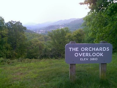
Starting Location: Orchard View Picnic Area
Ending: Tuggle Gap

I began the day near milepost 455 on the Blue Ridge Parkway after spending the night in my hammock. I was plenty warm and slept well, but I woke with a start - thinking that my hammock was being bumped by an animal or a person. However, nothing was there and there was no sound of an animal running away. It must have been a dream!

I passed the highest point on the parkway - 6047 feet. I was in the clouds at that point. I then descended to the Ashville area and got gas at about mile 380, near the folk art center. Average miles per gallon is well above 50. I asked for a Blue Ridge parkway map at the information center there, and was told that the map of the parkway is in short supply and new ones are not available. I had been told the same thing at the store at Mt. Pisgah.

I drove the short spur to the top of Mt. Mitchell, which tops out at 6684 feet. This is the highest point east of the Mississippi River, higher than Clingman's Dome by many yards. The temperature was 42 and the wind was measured at 25-35 mph. It was completely fogged out, and began to rain. I was told that this was much better than two days previously when there was an inch of snow on the ground.

It rained about an hour, and I was just dried out by the time I reached Linville Falls. Wow! The falls were beautiful to see and to listen to. To properly see them, I took a couple miles hike to all the observation points. Lying down next to the falls and listening to them was quite refreshing.

Soon after leaving Linville Falls, it began to rain again. There were pretty bridges at Linn Cove Viaduct, but I had my hands full just seeing the road in the rain and fog. It was still raining when I got to Blowing Rock and filled the tank with a little less than 2 gallons (mile 292) I got gas again at mile 175 (2.1 gallons)

I expected to camp at Rocky Knob - but the campground is at 3572 feet and it was cold and windy. Also, I found that there were no showers in the campground. So I went on a few more miles to Tuggle Gap where i got supper and a room for about $55. (Happy Birthday to Me)

The room is plain, with no TV, but it has a hot shower and heat. My bike is parked outside the door. It will be a nice night for reading.

Wednesday, May 17, 2006

Blue Ridge Trip - Day 1


Miles: 426
Begin in Beavercreek, OH
End Near Maggie Valley, NC
Weather: mix of sun and showers

This is a trip I have been looking forward to most of the winter. My plan is to drive the Blue Ridge Parkway. For several days beforehand, I have been looking at the weather patterns, and it looked like it was going to clear and beautiful on the southern end of the Blue Ridge Parkway by mid-week. Here it is Wednesday, and I have the opportunity to get out of Dodge for several days.

I started at 830, filling my gas tank in Beavercreek. My route proceeded south on US 68. I stopped at Mt. Orab for coffee and for a breakfast burrito in Ripley, OH. At 1120, I filled the tank in Paris KY, having gotten 127 miles out of the tank.

In Paris, I took KY 627 around Lexington. South of Paris, the road is flanked by beautiful rock walls and horse farms to the town of Winchester. South of Winchester, I stopped for a few minutes at Fort Boonesboro. The river valley is very pretty here, but there is not much more than an water park to recommend the stop. I had been reading about Boonesboro since I was a child and had never been here. I must admit to a little deflation at finally arriving.

Next came Richmond, KY where I took US 25 south. I had to stop for a moment at a police check point (drugs? alcohol?) and reached New Liberty, where my grandmother was raised.

I took I 75 to 25E. This road is a beautiful and not heavily traveled road that goes all the way to Newport TN. I filled the tank again at Newport and drove for 40 miles on I 40 to the Magee Valley turn off.

In Maggie Valley, I noticed that one of the small motels had a sign welcoming VROC. This is the Vulcan Riders and Owners Club, one of the Vulcan motorcycle groups on the internet. I stopped for a few minutes to say hello and then drove off to eat barbeque at a small diner. Unfortunately, I missed the motorcycle museum by 45 minutes.

I drove up from Magee Valley to the Blueridge Parkway and then north for a few miles to a turn-off picnic area (Orchard View) where I put my hammock up. The ranger kept driving by every hour or so for half the night, each time waking me with his car. He was probably trying to figure out where the motorcycle owner was.

Other than those interruptions, the night was nice and I got plenty of sleep.